

The princess slept in until eleven a.m. on Monday, and spent an hour concocting her own plan with TJ. "Mom, could we go down to Cumberland today and camp out with TJ? We could ride down the canal a few miles and camp". So, what started out as being a simple ride had now turned into an overnight adventure. The great gear round-up had begun!
 The outdoor storage shed is my domain. Half of the shed is allocated to modern camping, hiking and bicycling, and the other half to re-enactment gear. I have bins and shelves – a space for everything and everything in its place. In theory, that is… I tried to make it so that I could easily pick up what I need when we have to pack for a trip. The trouble is that I've also made it easy for the rest of the family to raid the gear and take what they'd like to use as well. In my alternate universe, everyone would put things back in its place. In my reality, well, I'll leave it to your imagination. Can you say "mom meltdown"? Two hours later, we had rounded up enough of the gear to equip the three of us and packed it into panniers and rack trunks. Lib helped me load the three bikes onto the car and we departed at 3:30.
Curiosity had gotten the best of me by the time I reached Stahlstown. I'm a sucker for back roads – the lure of the unfamiliar. The pleasant "voice" urged me to "go six tenths of a mile and turn right". Sucker was true – the road had dead-ended. I turned the car around and took a road I knew. I then became Luke Skywalker. I turned off the guidance system and used THE FORCE. We got onto Glades Pike (Route 31), a former Indian path, and soon passed Somerset and turned right to Garrett Shortcut Road. At Garrett, we found US 219 and followed it past Meyersdale (both are trail towns on the Great Allegheny Passage) and into the state of Maryland where we turned onto I-68, some twenty miles west of Cumberland.
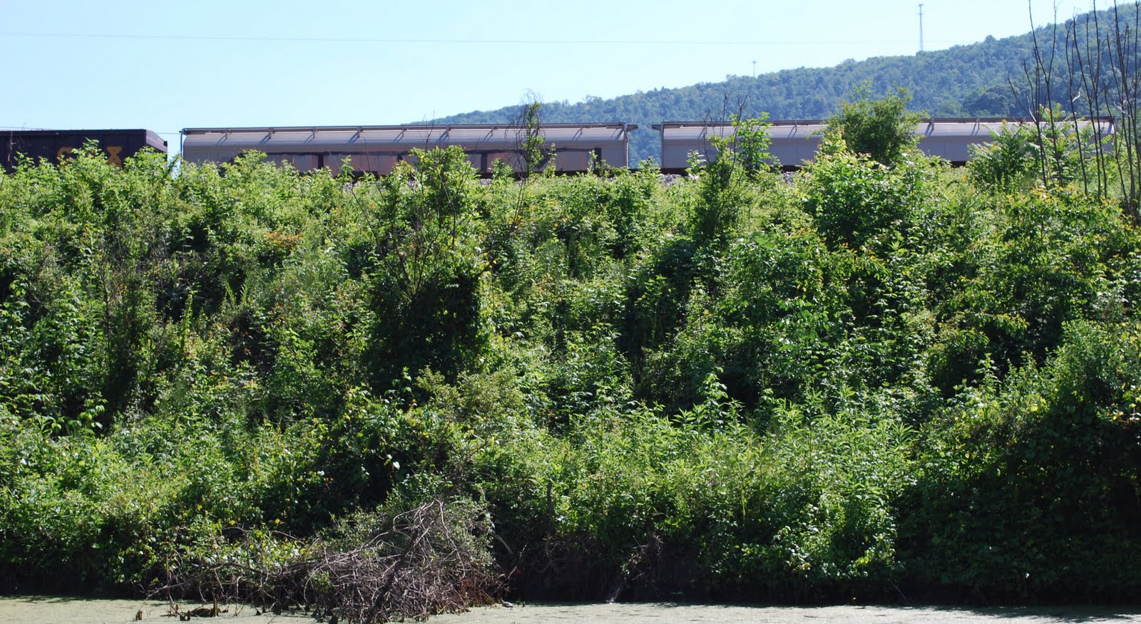
I resigned myself to the fact that it was getting late in the evening, so I didn't stop to take any photos along the way. (These pictures are from the return trip.) There was a ball game underway at the field next to the wastewater treatment plant. Trains were entering and leaving the switchyard across the canal – with the customary clanging and banging, the hum of diesel locomotive engines, pfssst of air brakes, steel-on-steel noises – sounds as familiar as a lover's caress.
A couple of miles outside of Cumberland, the trail capriciously changes from doubletrack to singletrack and vice-versa. The grass is growing tall along the edges and center of the path. Then the grasses disappear, and the dance of the mud-puddles begins. It's not a perfect trail. Accept it. Embrace it.


I rode on alone, lost in my thoughts. A voice from the opposite side of the canal interrupted the party-line in my head. I looked around (almost gave myself whiplash), my eyes focusing on the glint of steel razor-wire reflecting the sunlight through the sparse tree line. The stuff dreams are made of… o.k., well, nightmares. I took a quick assessment. Fenceline. Check. Trees. Check. Moat filled with man-eating crocs. Nope. Just a big ditch filled with fetid water. I'll be moseying along…
The Cumberland Federal Correctional Institution, located in the triangle of land between milepost 178 and 179, currently houses approximately 1200+ medium security inmates, and the adjacent
View Larger Map
minimum security camp houses 250+ inmates. The locals say "not to worry…" What, me worry? Not really, just a little unsettled. I'm more worried about train derailments than prison breaks. [My friend Neil (aka The Historian) and I witnessed a derailment outside of the Point of Rocks parking area a couple of years ago.]
The first 9 miles of C&O Canal National Park out of Cumberland are quite remarkable. It's a sylvan path that insulates you from the bustle of the Queen City. The tree line opens at opportunistic moments, much like Sally Rand's fans, giving a glimpse of farms, fields and mountains. There are residential areas, too – well-kept yards adjacent to the park. The rail line on the berm side of the canal – pay no attention to that distraction – it hides the vast train yard beyond. Mostly hidden from view are the two airports (alright - one small airport, one airfield), vast industrial complexes, and of course, the prison. PPG left the area in 1992, much of the factory demolished. What PPG leaves as a legacy is the name of the road, "Pittsburgh Plate Glass Road", and some wastewater lagoons along River Road. Allegany County Department of Economic Development took over the site and markets the area as the North Branch Industrial Park. FEMA's Emergency Housing Distribution and Logistics Center is located in the industrial park (you might recognize the hulks of trailers parked in the distance), as well as Hunter Douglas, the vinyl blind manufacturer.


I awoke the next morning (or else how could I be typing this?) after a fitful night. The trains crossing the river didn't bother me, but the constant drone of some big industrial machine did. At 5:30 am I was greeted by an irrepressible urge to run to the porta-john, and assaulted by a charley horse in my right adductor (inner thigh) muscle. It felt like I was running a three-legged race on one leg. I barely won the race. I had packed oatmeal for breakfast, but discovered that I failed to pack milk and sugar. No coffee for me either, then. Out came a can of beef stew from deep in the pannier, and a package of instant mash. Too much for one person to eat, TJ and I shared. Lib had strawberry-flavored oatmeal (yuck). I sent Lib to fetch water in the bucket to wash dishes with. "Mom – the pump handle's missing!" We had forgotten to check it out BEFORE we set up camp. We didn't really need the water, I had filled the Camelbacks and a couple of bottles before we set off, and we had only used 2 litres. We packed the dirty dishes in a plastic bag and put them away to wash later.

 I didn't get very far before I was challenged by a band of marauding geese. "None shall pass", I swore I heard one of them hiss. They were like the city toughs hanging out on the street corner. I was tougher… and I have the feathers to prove it. I then noticed the source of my sleepless night – the sign says "Mexico Farms LLC Pretreatment Facility". It handles the waste from Fibred, Inc. – a tenant in the industrial park. The spray devices are atomizers that emit water for odor control purposes. Odor wasn't a problem today, but it evidently was in the past:
"Mexico Farms, LLC -- Allegany County - On July 14, (2005) MDE and Mexico Farms, LLC (MFLLC) finalized a penalty settlement agreement whereby MFLLC agreed to pay $7,000 to the Maryland Clean Water Fund to resolve nuisance odor violations that occurred at the MFLLC Fibred Wastewater Treatment Plant during the period April 9 through June 21, 2004. Status: Case closed. (Reference #PS-06-0161). "

Today's odor was the sweet smell of honeysuckle. It permeated everything. Blackberry brambles, still dressed in dainty flowers, reached out past their confines every once in a while to snag you. Immature raspberries, cloaked in fuzz could be seen as well.


Lots of cyclists were heading out of Cumberland, working their way down toward DC. It was a group of riders from Exploritas (formerly Elderhostel). They waved as they passed by. We were encountering more and more people on the towpath. I saw four cranes up ahead. Not wildlife… construction equipment. I had noticed that the ball fields were torn up around the sewage treatment plant, but today I got a closer look (that brown building with the yellow stripe was the old concession stand):


Cumberland Wastewater Treatment Plant ENR Upgrade – Allegany County
A $6,000,000 ARRA grant, along with a $25,779,000 grant increase from the Bay Restoration Fund, will fund the planning, design, and construction of Enhanced Nutrient Removal (ENR) facilities at the existing City of Cumberland Wastewater Treatment Plant at an approved design capacity of 15 million gallons per day. After ENR upgrades, the Cumberland Wastewater Treatment Plant will reduce its nitrogen discharge by 63 percent and phosphorous by 85 percent, significantly reducing nutrients discharged to the Potomac River and ultimately to the Chesapeake Bay.


(I just love pictures of sewage digesters)
By the time I rolled into Cumberland, Lib and TJ had off-loaded the gear into the car. We hastened to the Crabby Pig for a quick bite before resuming our travels up to the Eastern Continental Divide.


No comments:
Post a Comment